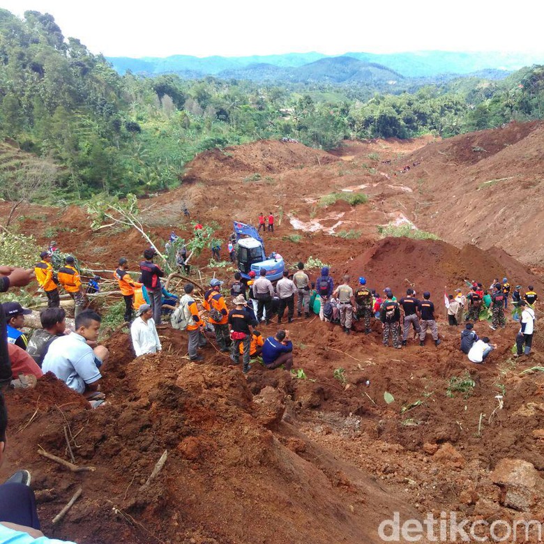
Major landslide disaster occurred again in Indonesia. Landslides occurred in the village of Bunaran Pulung, Ponorogo on Saturday 1 April 2017 at 08.00 WIB. In the event occurred with about 800 M of long landslide, and 20m height. Landslide hit homes and people that are harvesting ginger at the bottom of the hill slopes.
Based on the data of Health Crisis Center, the last data of the missing victims reached 23 people, 6 people were seriously injured / hospitalized, 916 minor injuries / outpatients and 329 people still displaced to safe place.
The Rapid Assessment Team of Gadjah Mada University (UGM) Yogyakarta with the National Disaster Management Agency (BNPB) and the Center for Volcanology and Geological Hazard Mitigation (PVMBG) directly conduct research on the landslide,
In the results of this study, there are several factors that cause landslides. under natural conditions it already shows the high risk of landslides. But the cause of the landslide due to the slope of the cliff is quite steep, in addition to its rocky structure of the corrotion of the volcano.
In addition, almost all the land on the hill around the disaster site is now a ginger field. The hill should not change its function into fields and fields. Changes in soil function make the soil unstable condition. So it becomes a trigger landslide.


.png)


